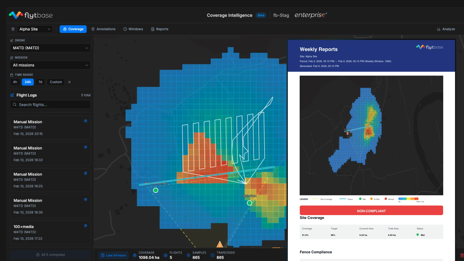
Security drone programs sell coverage SLAs to enterprise customers. The customer wants proof every checkpoint was inspected. Flight logs prove the drone flew. They do not prove the camera looked. A drone can fly over a checkpoint while looking elsewhere. Coverage Intelligence projects the camera's field of view onto the ground. Every patrol becomes provable coverage, not just hours flown.
Coverage Intelligence projects the camera's field of view onto the ground. Every telemetry sample contributes to a spatial heatmap. The operator defines obligations: boundaries, fences, and critical points. The system tracks every commitment continuously and surfaces gaps before the customer asks.