


Autonomous Drones are becoming an essential part of Highways Infrastructure.
Australia’s busiest road corridors now have more than just cameras—they have autonomous eyes in the sky. With real-time aerial visibility and seamless integration into traffic management systems, autonomous drones are no longer just a pilot project—they’re a pivotal part of the future of traffic operations.
Traditionally, Australia’s roads have been among the busiest and most vital arteries for commerce and daily life. For Transport for New South Wales (TNSW), keeping these corridors safe and efficient is a constant challenge, with recurring traffic incidents, congestion, and emergencies demanding rapid and informed responses.
TNSW looked beyond just ground personnel or static CCTV feeds. It demanded a dynamic system that can see, respond, and support decisions in real time.
That’s why TNSW turned to FlytBase, a platform that connects all the dots—drone-in-a-box hardware, airspace compliance, fleet operations, emergency response coordination, and live traffic updates—into a single, centralized system.
The Challenge: Managing Australia’s Road Networks
TNSW’s network spans urban freeways and remote highways, requiring incident management and traffic monitoring at a scale few agencies face. Traditional CCTV, while extensive (with over 1,700 cameras), leaves coverage gaps—especially in areas not easily accessible or during fast-moving incidents.
On-ground resources are often stretched thin, and delays in situational awareness can lead to longer traffic jams, increased risk for responders, and higher costs for the community.
TNSW needed a solution that could deliver rapid, safe, and flexible aerial visibility—without putting more boots on the ground. However, regulatory hurdles such as CASA’s requirements for beyond visual line-of-sight (BVLOS) drone operations, and the need for real-time, actionable data, add to operational complexity.
The Solution: FlytBase + Drone-in-a-box as the Infrastructure for Highways
FlytBase’s platform forms the digital backbone of TNSW’s remote drone operations.
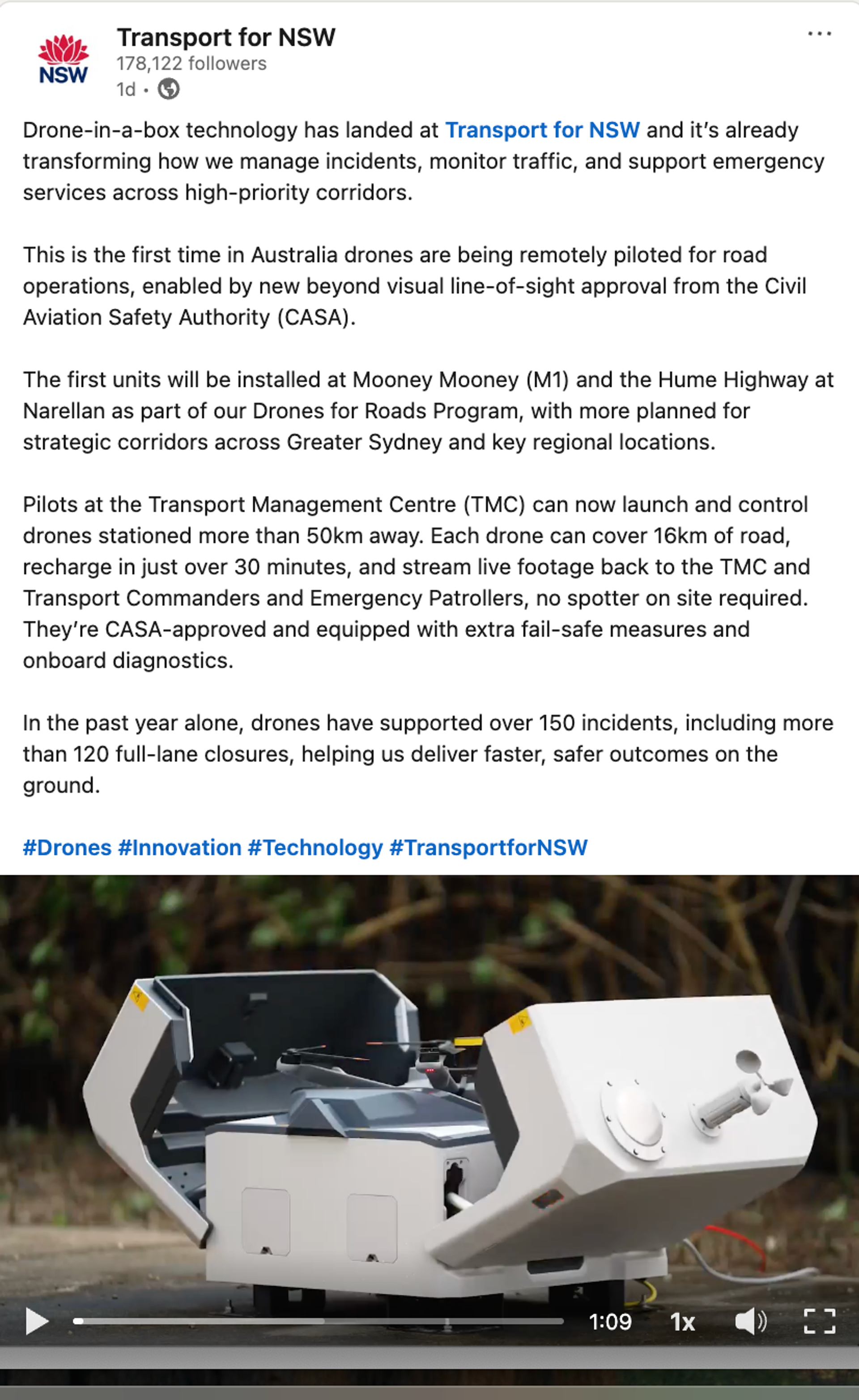
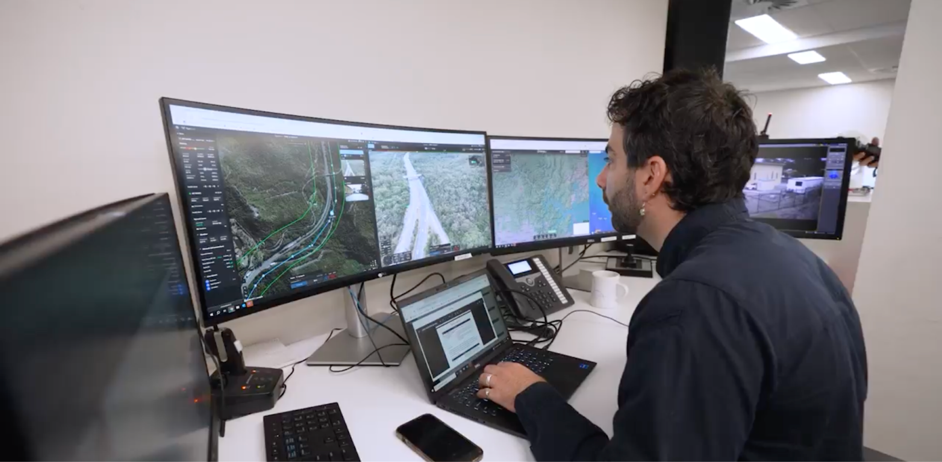
Integrated with drone-in-a-box hardware, it enables accredited pilots at the Transport Management Centre (TMC) to remotely launch, navigate, and land drones stationed over 50km away. Automated workflows handle pre-flight checks, flight paths, and battery charging, allowing for scheduled or on-demand missions without on-site pilots.
Centralized fleet management through FlytBase’s dashboard ensures TNSW can coordinate a growing fleet—currently over 80 drones, with five pilots at the TMC and 100 accredited pilots across the state—delivering coverage where and when it’s needed most.
“When a drone is in the air, we can clear hazards and facilitate a return to normal operation much faster. Remote flying means the TMC can keep a closer eye on known hotspots, and stream information to our Commanders and Emergency Patrollers before they arrive at the scene.”
— Craig Moran, Executive Director of Operations Management, TNSW
Key Features and Technical Highlights
- BVLOS Operations with CASA Approval: TNSW is the first in Australia to receive CASA approval for BVLOS drone operations on road corridors, allowing for rapid deployment and safe operation even around highways with traffic moving at over 100km/hr.
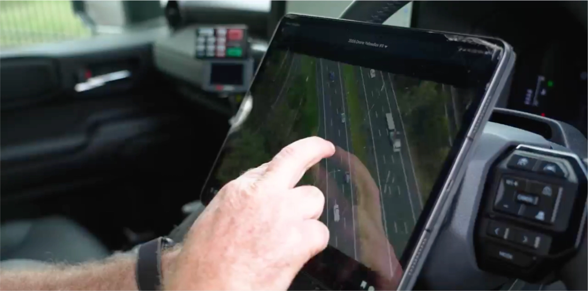
- Live Streaming and Real-Time Data: Drones provide live video feeds and telemetry to the TMC and field teams, supporting faster, more informed decision-making and allowing real-time updates for drivers via apps like Live Traffic.
- AVSS Parachute Integration: Each drone is equipped with AVSS parachute systems, offering both autonomous and manual emergency landing capabilities—meeting stringent safety standards and minimizing risk during critical failures.
- Fail-Safes and Onboard Diagnostics: Automated health checks, approved flight areas, and system diagnostics ensure reliable performance and compliance.
- Rapid Recharging and Redeployment: Drones can recharge in just over 30 minutes, ready for multiple missions in a single day.
- Guest Sharing: FlytBase’s secure guest sharing feature enables real-time sharing of live video and telemetry with emergency services and stakeholders, supporting coordinated responses.
- Widespread and Flexible Coverage: Each drone covers up to 16km of road per deployment, supplementing existing CTV and providing a rapid response tool during holiday traffic peaks, major events, and in areas where fixed cameras cannot reach.
Project Success: TNSW’s Achievements
- Responded to over 150+ incidents in the past year, including 120 full-lane closures.
- During recent school holidays, TNSW completed 160 traffic monitoring and incident response missions totaling nearly 100 hours in the air.
- Projected annual cost savings: $71 million in travel time, $24 million in secondary incidents, and $23 million in vehicle operating costs.
- Drones supplement over 1,700 CCTV cameras, providing extended line of sight and rapid deployment for asset inspections, detour planning, and emergency response.
- Drones have delivered a significant reduction in disruption recovery times, helping clear hazards and restore normal operations faster.
“With an eye in the sky, detours can be put in place faster and information provided on apps like Live Traffic. No one wants to be stuck at the back of a queue of traffic and drones will help reduce the severity of traffic jams around road incidents.”
— John Graham, NSW Minister for Roads
The Power of Partnership: FlytBase & TNSW
FlytBase’s collaboration with TNSW is built on a shared goal: safer, more efficient roads for everyone. We tailored our solution to TNSW’s regulatory and operational requirements, supporting both current deployments and future expansion across Greater Sydney and regional corridors.
“This is so much more than flying drones remotely—it’s about making drones part of the city infrastructure by making them safe, and smart at enterprise scale. For TNSW, our platform acts as the orchestration layer that brings together hardware, compliance, fleet intelligence, and real-time integration with traffic and emergency systems. Inspired by TNSW, we look forward to the adoption of DiaB systems for traffic management at a mass scale in the future.”
- Achal Negi, Director of Business Development, FlytBase
Conclusive Note
What Transport for NSW has built—with FlytBase as its central nervous system—is a blueprint for the world’s next-generation traffic management systems. Autonomous drones will not just supplement emergency and traffic operations—they’ll define them. Whether it’s faster hazard detection, better coordination with first responders, or actionable visibility at scale, the future lies in systems that can see, think, and act.FlytBase is making that future real—today. For transport management organizations looking to improve operational efficiency and public safety, autonomous drone operations offer a proven, scalable solution.
“With an eye in the sky, detours can be put in place faster and information provided on apps like Live Traffic. No one wants to be stuck at the back of a queue of traffic and drones will help reduce the severity of traffic jams around road incidents.”
— John Graham, NSW Minister for Roads