

Highway incident response
Launch drones automatically on incident triggers to provide TMC operators live aerial views of crashes, hazmat spills, and traffic backups before responders arrive.

Transportation
Autonomous drones launch within minutes of incident reports, providing live aerial views of crash scenes, congestion patterns, and infrastructure damage so transportation operations centers can coordinate response and accelerate clearance.

Launch drones automatically on incident triggers to provide TMC operators live aerial views of crashes, hazmat spills, and traffic backups before responders arrive.
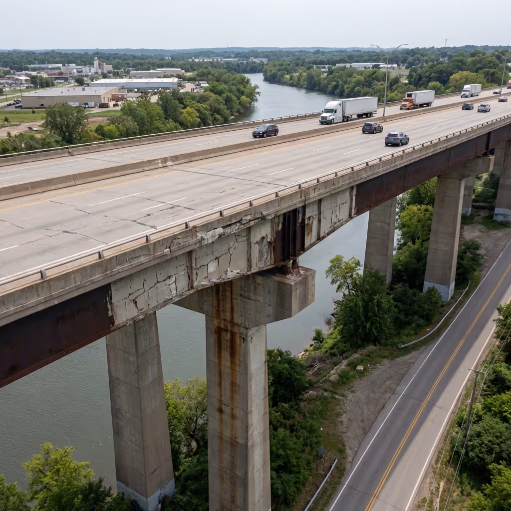
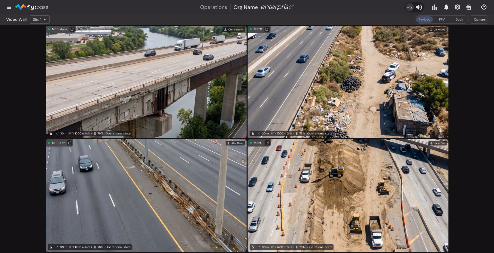
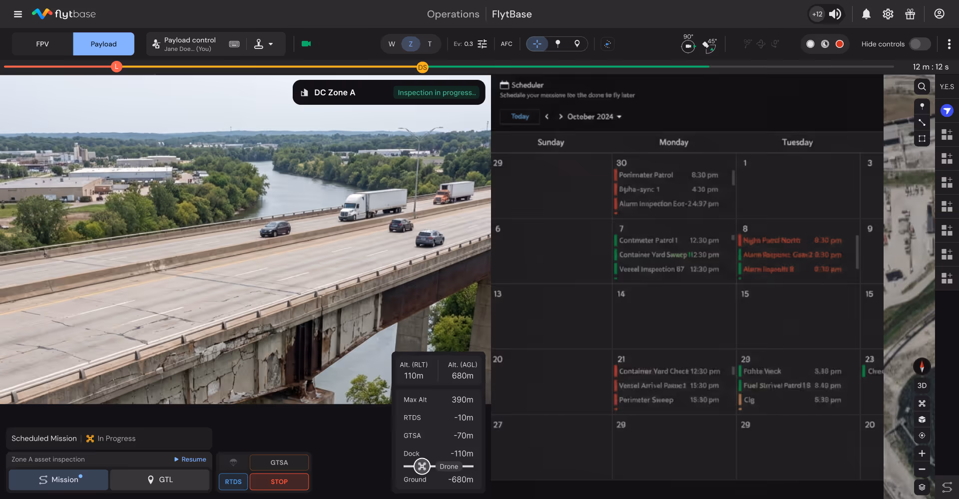
Capture trusses, bearings, decks, and underside structures from consistent vantage points without lane closures or snooper trucks.
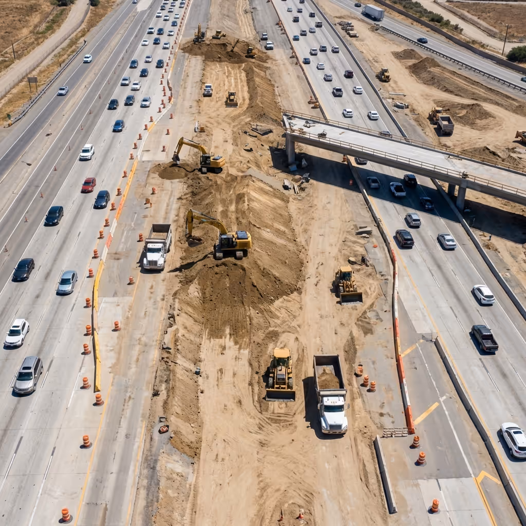
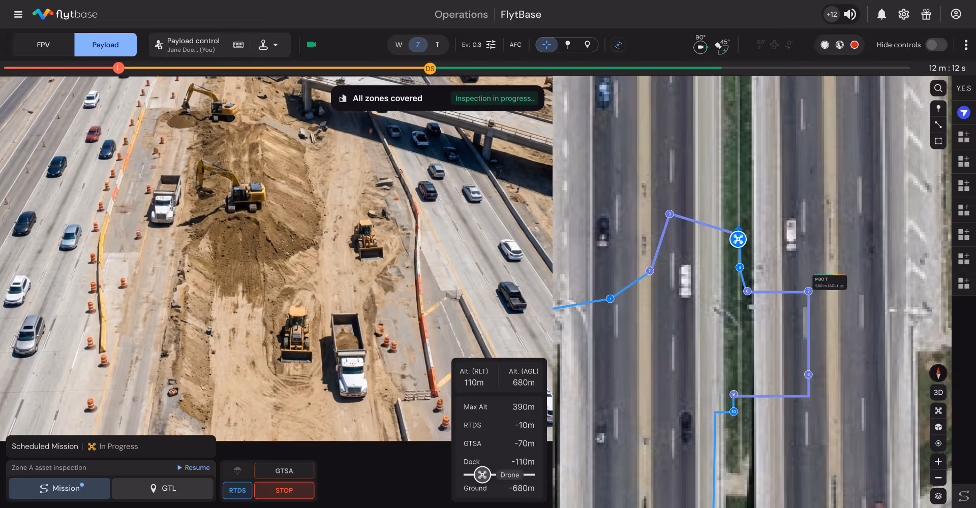
Generate daily orthomosaics, volumetric earthwork analysis, and stakeholder reports without surveyor mobilization across active corridor projects.
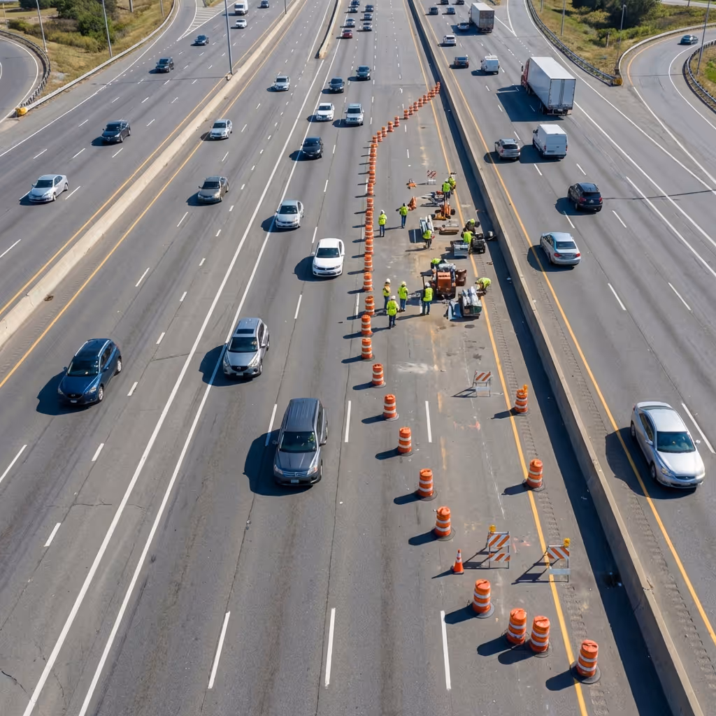
Document barrier placement, signage compliance, and worker positioning across active construction zones to reduce liability and worker injury.
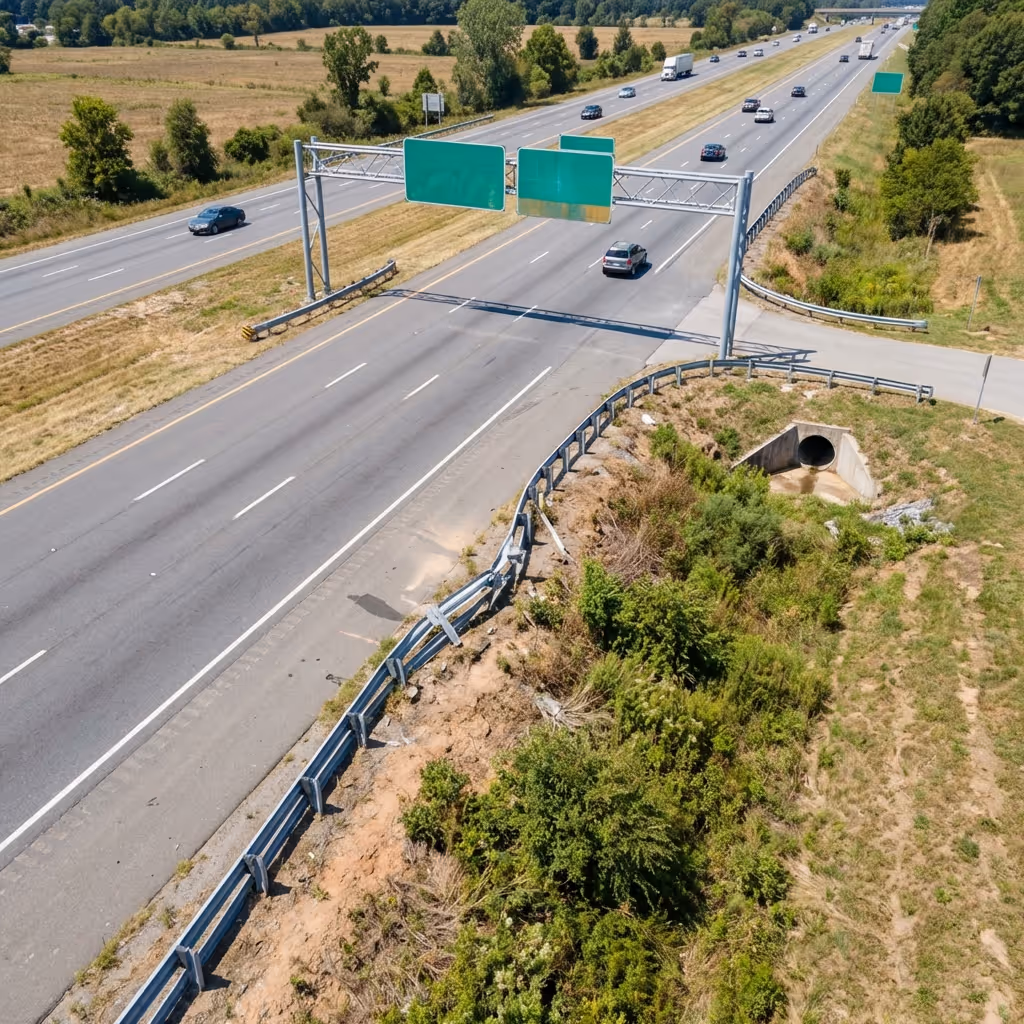
Document pavement distress, signage conditions, drainage performance, and right-of-way encroachments through scheduled aerial surveys.
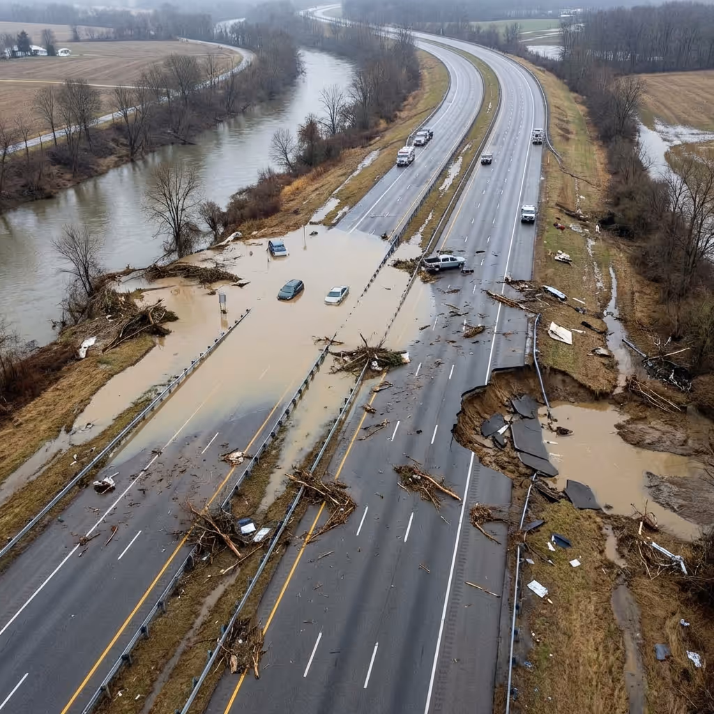
Launch automated post-storm flights to document flooding, washouts, and debris before maintenance crews arrive, accelerating restoration decisions.

Provide live aerial views of stadium egress, parade routes, and major event traffic patterns to coordinate signal timing and lane management.
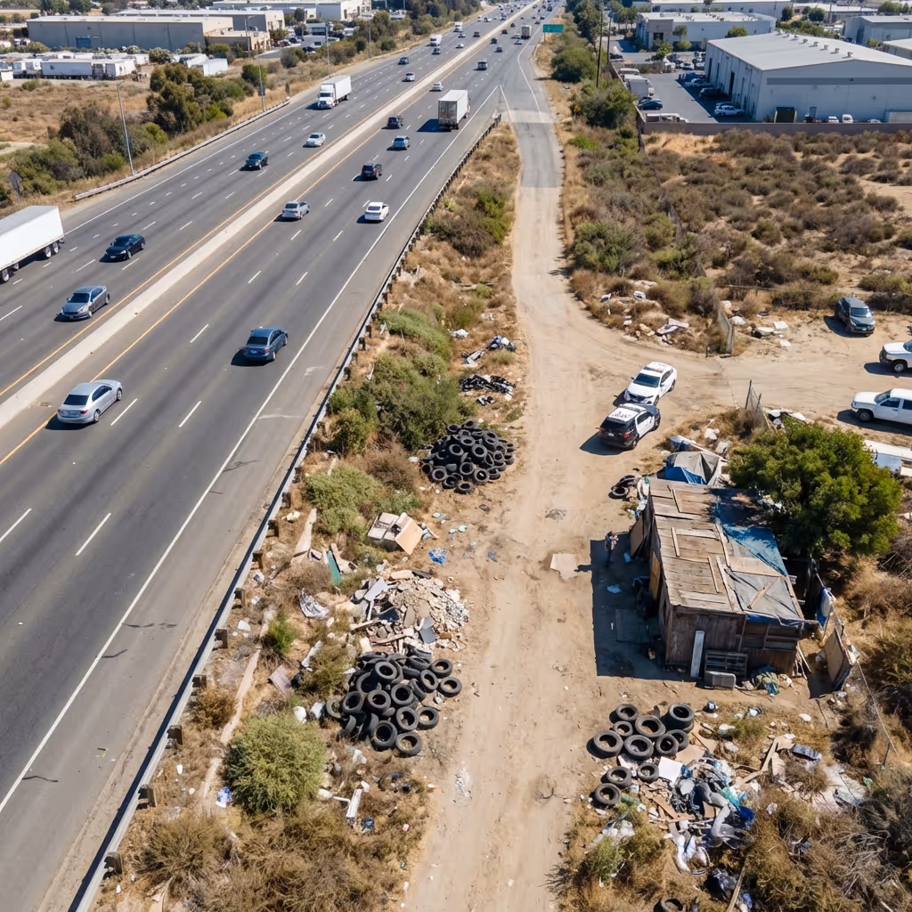
Identify illegal dumping, unauthorized construction, and vegetation encroachment within transportation corridors to protect ROW and prevent liability.
Customer Stories
Assist transportation teams by automatically classifying incidents, identifying bridge defects, tracking construction progress, and detecting safety violations, reducing manual review burden across corridor missions.
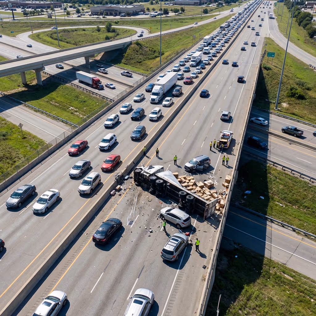
Distinguish crash severity, lane blockage, and hazmat indicators from aerial imagery to inform TMC response priorities and resource dispatch.
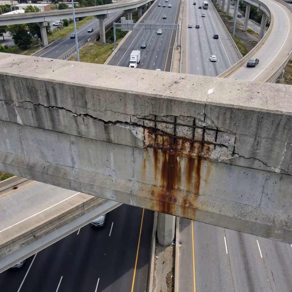
Identify cracking, spalling, corrosion, and section loss on bridge structures through high-resolution imagery analyzed across recurring missions.
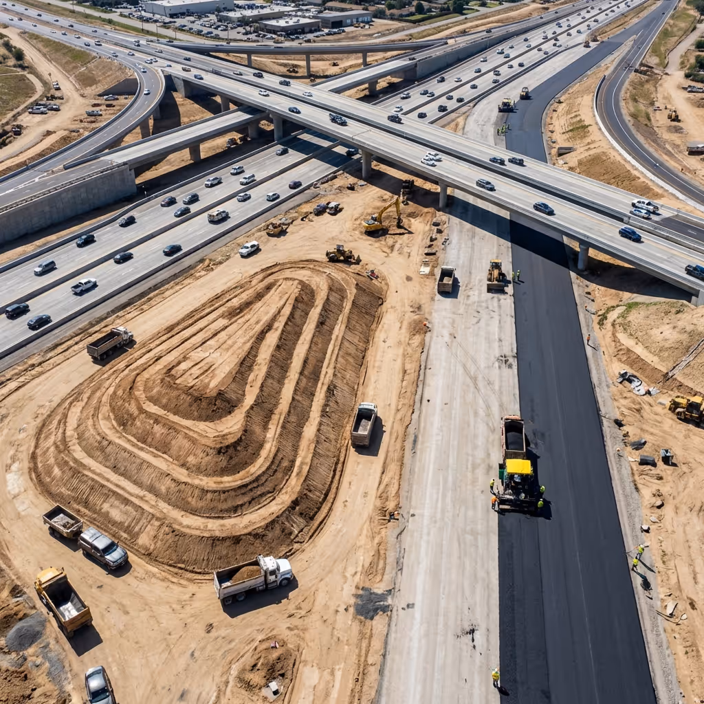
Compare week-over-week aerial imagery to quantify earthwork volume, paving progress, and structural milestones with automated reporting.
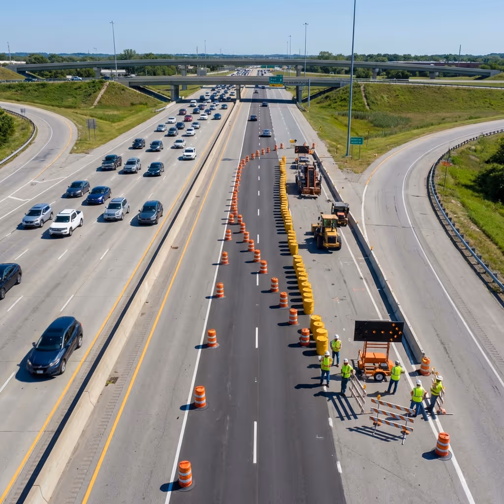
Detect missing barriers, improper signage, and worker PPE violations across active work zones to support DOT safety audits.
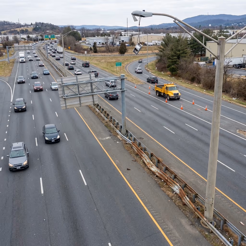
Identify pavement distress patterns, drainage failures, and signage deterioration through automated comparison across scheduled inspection flights.
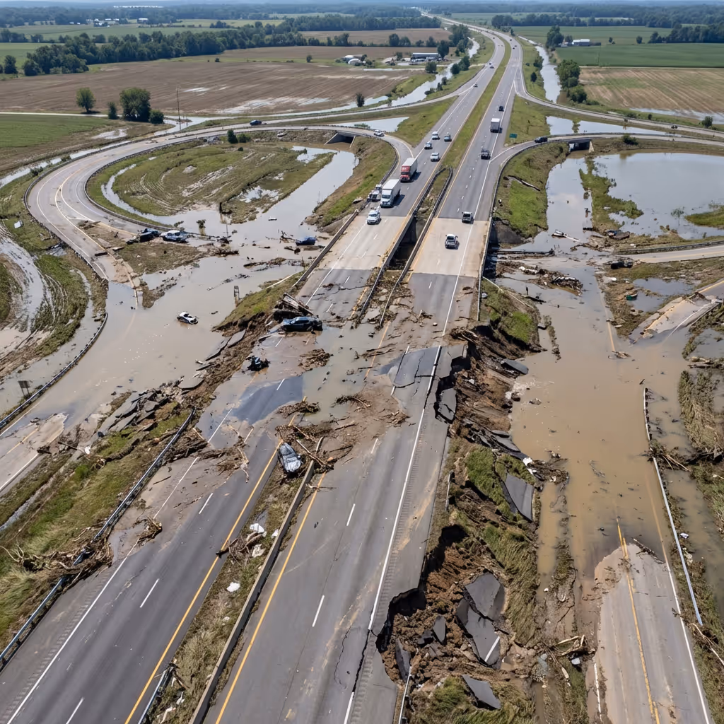
Categorize post-storm damage by severity to prioritize maintenance crew dispatch and accelerate insurance documentation.

Quantify vehicle counts, speeds, and congestion patterns from aerial video to support signal timing and corridor planning decisions.
Highlight new structures, dumping, or vegetation growth within ROW boundaries by comparing imagery across recurring corridor surveys.
Built to integrate into transportation environments across drones, sensors, traffic management systems, and enterprise applications without disrupting existing operations or maintenance workflows.

Support 24/7 autonomous operations with enterprise-grade drones, weatherproof docking stations, and mission-specific payloads — thermal cameras, zoom lenses, spotlights, loudspeakers, and more — orchestrated across diverse environments through one autonomy platform.
Browse supported hardwareOrchestrate incident response, inspection missions, AI agents, and corridor reporting through unified autonomy software.
Explore the platform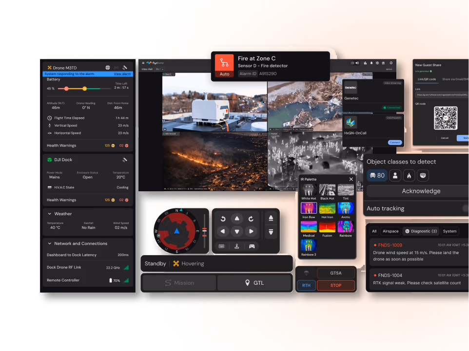
Integrate with CAD and dispatch, traffic management, VMS, GIS, CMMS, and photogrammetry tools to fit existing transportation operations.
Streamline BVLOS and corridor approvals with documentation templates and compliance workflows for transportation operations.
Learn moreFlytBase provides the reliability, intelligence, and operational maturity required to run autonomous drone programs at scale across transportation corridors and infrastructure.
Operate 150+ autonomous drone deployments with proven uptime and production-grade reliability across transportation corridors.
Apply computer vision and analytics designed from the ground up for corridor operations, not generic retrofitted capabilities.
Meet stringent DOT and agency requirements with SOC 2 compliance, encrypted transmission, and flexible deployment models.
Support in-country data residency, regional compliance needs, and local language requirements for multinational transportation programs.
Run 24/7 unattended dock-based operations across corridors without manual piloting or increased operator workload.
Rely on deployment assistance, training, and responsive support teams experienced in DOT and transportation workflows.
Connect with our drone autonomy experts to enable rapid incident response, continuous bridge inspection, and automated work zone safety verification.


