Coverage Intelligence
Turn drone flight logs into visual proof of what your cameras actually covered.
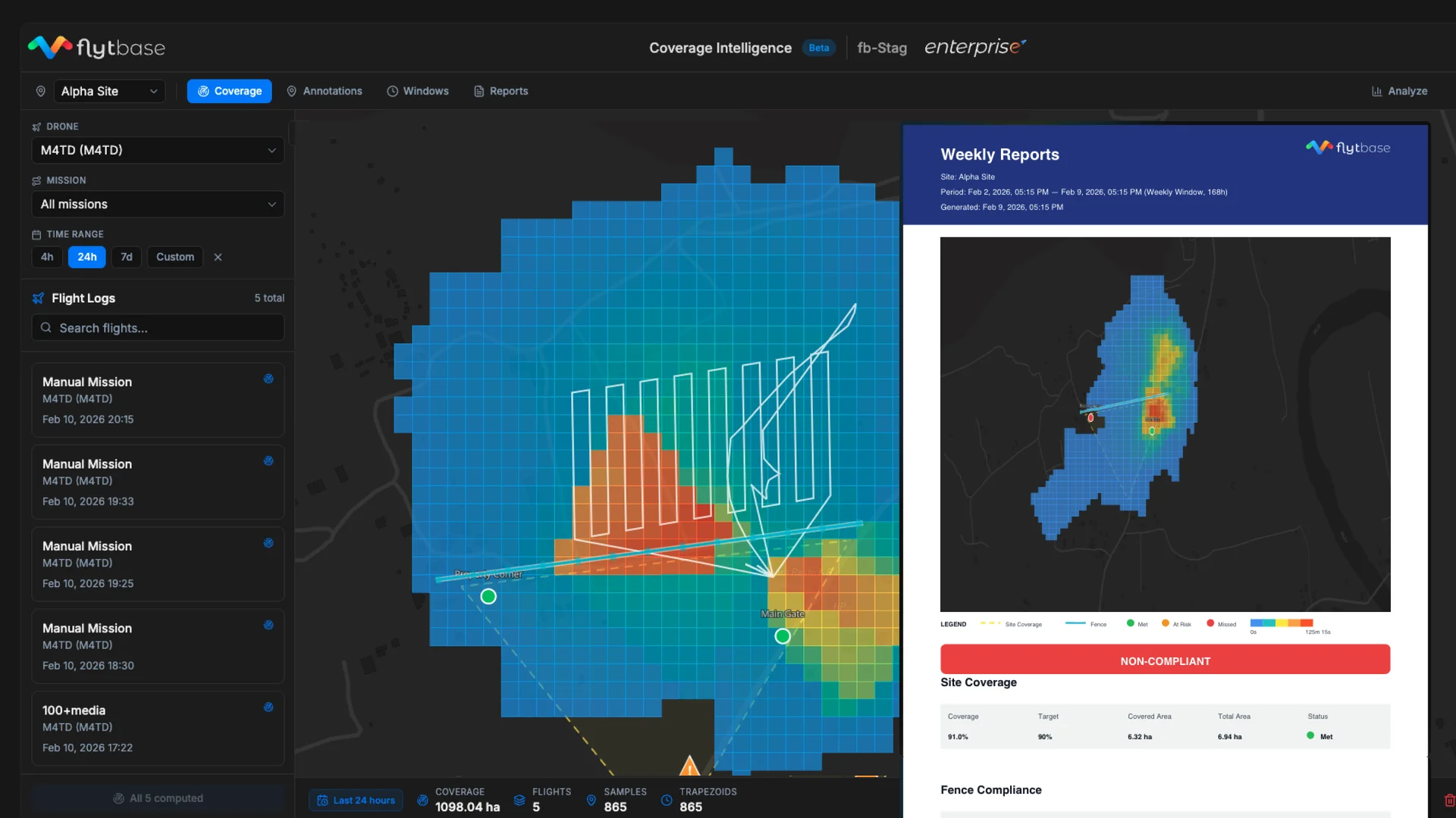
Security drone companies guarantee their clients that specific areas will be visually inspected at defined frequencies, but today they can't prove it. Flight logs show where a drone flew, not what its camera actually saw, a drone can fly directly over a checkpoint while its camera points the opposite direction. When customers ask for patrol proof, operators can only offer flight counts and hours, which say nothing about actual coverage quality.
Coverage Intelligence closes this gap by projecting the camera's field of view onto the ground for every telemetry sample, producing a spatial map of what was actually observed. Operators define their obligations, site boundaries with coverage targets, perimeter fences requiring inspection, and critical points of interest with dwell time thresholds - and the system continuously evaluates whether those commitments are being met.
The result: operators can instantly see blind spots, track compliance across daily/weekly/monthly windows, and generate professional PDF reports proving to enterprise customers exactly what was inspected, how thoroughly, and where gaps remain. An embedded AI agent lets supervisors query coverage data in natural language.
In short, it transforms the question from "where did our drones fly?" into "what did our drones actually see?", which is the only question that matters for SLA compliance.